Before a road trip, it's always wise to consult the map - or eat it, if it happens to be a cookie.

To make our edible road map, the children patted out a batch of sugar cookie dough (click here, for the recipe) into the shape of Montana. Actually, they used slightly more than 3/4 of a batch of dough to form the state, setting the rest aside, to use for decoration.

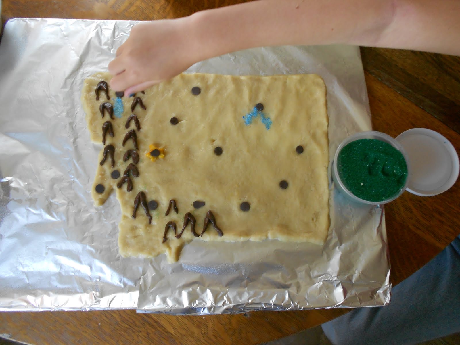
When they had it roughly in the shape of Montana, they added chocolate chips to mark the "large" cities and major towns, with a tiny blob of the extra dough, mixed with a drop of yellow food coloring, as a star, under Helena, the state capital.

The rest of the dough was mixed with a few melted chocolate chips, and turned into mountain ranges.

Blue sugar (sugar + a drop of blue food coloring), was sprinkled on for Flathead Lake (rumored to be the home of a cousin of the Loch Ness Monster), and the Fort Peck Reservoir (where the T-Rex are being found).

They decided the state looked too plain, and added some green sugar for color.
After correcting the placement of the Missoula chocolate chip, I baked the cookie for about 20 minutes at 300 degrees Fahrenheit.

When it had cooled, we piped on butter cream frosting, in blue, for rivers. We didn't get too involved with the rivers, because we hope to study those, later. But, we did briefly discuss the continental divide, which we hope to cross on our trip, and its effect on the direction the rivers flow.

Then, because it was supposed to be a road map, we piped on roads - green for interstates, and pink for highways.

It ended up being a messy cookie - but a lesson we could sink our teeth into.
You can find more fun with history and geography, at this week's History and Geography link-up, hosted by All Things Beautiful.
It's great to be a homeschooler.


13 comments:
What a great geography lesson!
Yum! That is one tasty looking map!
Superman and Princess saw this and heartily approve of the activity. And now they want to do the same thing for Texas.
I so love this cookie map! I am sure the kids enjoyed eating it as much as they did making it.
Now this is a very creative way to learn geography!!
That is so very neat - eating your own state! Great lesson!
awesome idea! I'm gonna have to do that . . one of these days!
Oh-my-heavenly-days!!! We will so be adding this sweet treat into our USA study this year!
AWESOMENESS!!!!
Montana is a great state to make a cookie with- nice and big! ;) What a great hands (and mouth) on project.
What a fun and yummy idea! I will definitely have to remember this one before our next road trip! Love it!
How fun! I want to try this! I'm thinking cookie dough and icing make a more memorable impression than paper and pens!
Hi, nice to meet you. Thanks for letting me stop by your site. I found it on Kathleen's "Growing Up MK" site.
I too am a homeschooling mom who often borders on unschooling. What a fabulous idea to do a cookie map! I love it. May I link my readers to you and your site here to see this?
Jennifer
www.jenniferdougan.com
Jennifer - Thanks! And, yes :)
Post a Comment